Cerro Champaqui
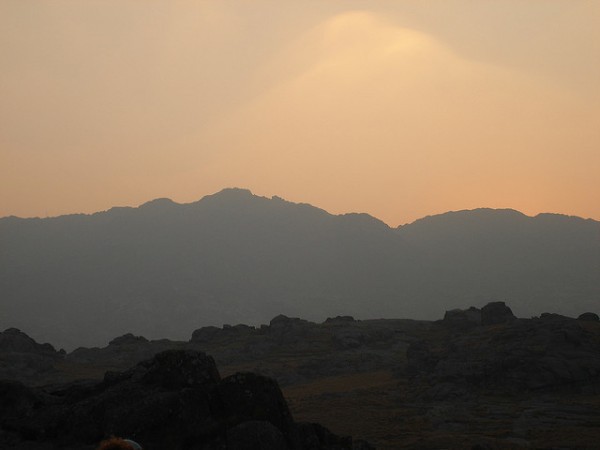
Cerro Champaquí is another destination worth visiting in the Province of Córdoba.
This site is the highest in the geography of Córdoba, reaching 2,884 meters above sea level. It is located within the Los Comechingones mountain range, a name given in honor of the ancient inhabitants of the area.
The hill has a very old formation, nearly 300 million years old. It is built from metamorphic rocks with shifting shapes, and it is a site rich in mica and quartz.
From the city of Córdoba to the summit of the hill is a distance of 165 kilometers; from La Aldea, it is only 38 kilometers away. There are three ways to reach the hill: leaving from Villa Yacanto (with off-road vehicles), from Villa Alpina (on foot), or from the Traslasierra Valley (climbing at a medium difficulty level).
The road that connects the hill with Yacanto is known as the Camino al Cerro Los Linderos, since it ‘borders’ (or limits) Champaquí. When you set out from Yacanto, you will need to climb and you will notice how the surrounding vegetation changes markedly. You pass from pine forests to puna grassland, talas and molles, low-lying species with a tufted appearance.
When you reach an altitude of 1,637 meters, you will find a sign: ‘Los Corrales’, an important meeting place for Comechingón culture for a thousand years. In the area you can still see the ruins of stone houses, grazing sites and corrals. Nearby are the Los Tabaquillos River and, very close to it, Durazno.
Keep in mind that there is a marked temperature difference between the summit and the base, so we advise you to bring warm clothing if you plan to climb the site. If the day is cloudy, leave the trek for another day. Wear comfortable footwear and appropriate clothing.
Source | Villa Yacanto
Photo | Flickr – Franaloi
2 comments · Comment
2 comments